Through the Heartland - Part 2 Cross Country Motorcycle Journey
Leaving Madison Behind
Friday morning dawned with the realization that my comfortable stay in Madison had to end. Thanks to Ranger01, I had detailed notes for one of her favorite routes through the back roads of Wisconsin. What a gift that turned out to be! Wildcat State Park and Highway 33 provided the perfect playground to get comfortable with the bike’s handling under the weight of my gear.

The route eventually led me into South Dakota, where I reconnected with Route 90 to cover more ground. I ended that day in Sioux Falls, settling into a cheap camp cabin about 200 miles from the Badlands and Black Hills.
Sturgis Complications
The next morning, locals informed me that Sturgis was still in full swing. This explained why Route 90 was choked down to a single lane in both directions in some areas, with road construction adding to the challenge. The congestion was most noticeable at fueling stations, and the South Dakota sun showed no mercy.
GPS Casualty
About 50 miles from the Badlands scenic route exit, I took a short break and noticed my GPS mount was warm to the touch. I didn’t think much of it at the time. After taking a few gulps of warm water from my canteen, I hit the road again.
Then came the moment that would change the rest of my navigation plans - as I approached the first sight of water all day, an expansion joint rattled my whole bike and knocked my GPS free from its mount. I watched helplessly as it met with what appeared to be nine of the eighteen wheels of the semi behind me. Paper maps would be my companion for the rest of this journey.
The Badlands: An Alien Landscape
The Badlands took my breath away - it was truly like nothing I had ever seen before. Despite the intense heat, a good breeze made it bearable, and I was content to plot along at a very relaxed pace, soaking in the otherworldly scenery.


The route through the Badlands ended quicker than I expected, and while fascinating, I had no real desire to revisit. The desert-like conditions also convinced me that camping there would be unwise, especially given the early hour. I decided to push on to the Black Hills.
Black Hills and Rushmore

This is where things got interesting. I took a few scenic roads into the Black Hills, and while it started promisingly, entering through Rushmore made it clear that Sturgis was still at full throttle. After a quick bite to eat, I studied the park map, but things were more confusing than helpful.
Night Navigation Mishap
In my haste to find the most remote camping possible, I failed to notice that my targeted campsites were roughly 20 miles back on what amounted to goat trails. One wrong turn led to another until I found myself lost in the Black Hills Experimental Forest. After giving up on finding the Mystic campground in the dark, I backtracked 20 miles of dirt path and finally found a Super 8 with vacancy at a reasonable price.
The Approach to Yellowstone
The next morning, I woke ready for another full day of travel. Rain was setting in as I packed up my gear. I took a quick swing past Rushmore, but the clouds made it barely visible, let alone photo-worthy.
After navigating the twisties of the park, I picked up Route 90 above Sturgis at Spearhead. Tired of the departing Sturgis crowds, I fueled up at the intersection of Routes 16 and 14 near Gillette. Looking at my map, I noticed these roads would reconnect near the Big Horn Mountains - this decision would prove crucial.
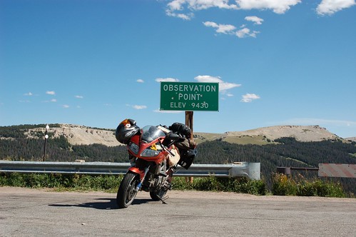
Big Horn Mountains: A Hidden Gem
The back route took me through Wyoming farmland and the foothills near Sheridan. I passed through only three small villages, all with populations under 150. I made it through, but barely, running on fumes.

The foothills provided a stunning preview of what was to come:


The Fire That Changed Everything
Finally reaching Big Horn exceeded all expectations. The road up was challenging, but every second was pure joy. The SV’s fuel injection struggled with the elevation, but we pushed through.

Near the summit, I noticed something ominous - a plume of smoke in the distance. Little did I know this would dramatically alter my plans.

The final agenda was to reach Yellowstone and find a campsite for a few days. From the town of Cody, Yellowstone was 50 miles and a mountain away. But that smoke I’d seen earlier? It had evolved into something far more serious.
Within twenty miles of the entrance, conditions changed drastically. Despite my reservations, I pressed on, documenting the increasingly apocalyptic scene:


The rangers at the park entrance delivered the sobering news: the fire had just engulfed the road around the mountain, claiming nearly 10,000 acres. The last time this gate had closed, it stayed shut for 10 days. They strongly suggested finding an alternate route.

The air no longer smelled just of burning timber - it burned my throat and eyes. I made a mad dash back to Cody, found a room for the night, and captured this final shot of the view from town:


With Yellowstone now off the table, I would need to revise my plans. The next leg would take me toward Glacier National Park, where I would begin the Canadian portion of my adventure.
Stay tuned for Part 3: The Pacific Northwest - Glacier, Banff, and the Canadian Adventure
This is part 2 of a 5-part series documenting my cross-country motorcycle journey. Follow along as I make my way from Philadelphia to the Pacific Coast and back, covering over 12,000 miles of American roads.